In the browser, without an account
Search an address or a parcel and it is all there. Orthophoto, hillshade and contours, buildings in 3D, print, and a link to the view you are looking at. Free, no sign-in.
Cadastre, buildings, planning acts, flood zones, protected areas and utility corridors: the spatial data of a whole country, documented layer by layer, in your browser and in your CAD. Draw on top of it, publish the project to the map, and share it as a link anyone can open.
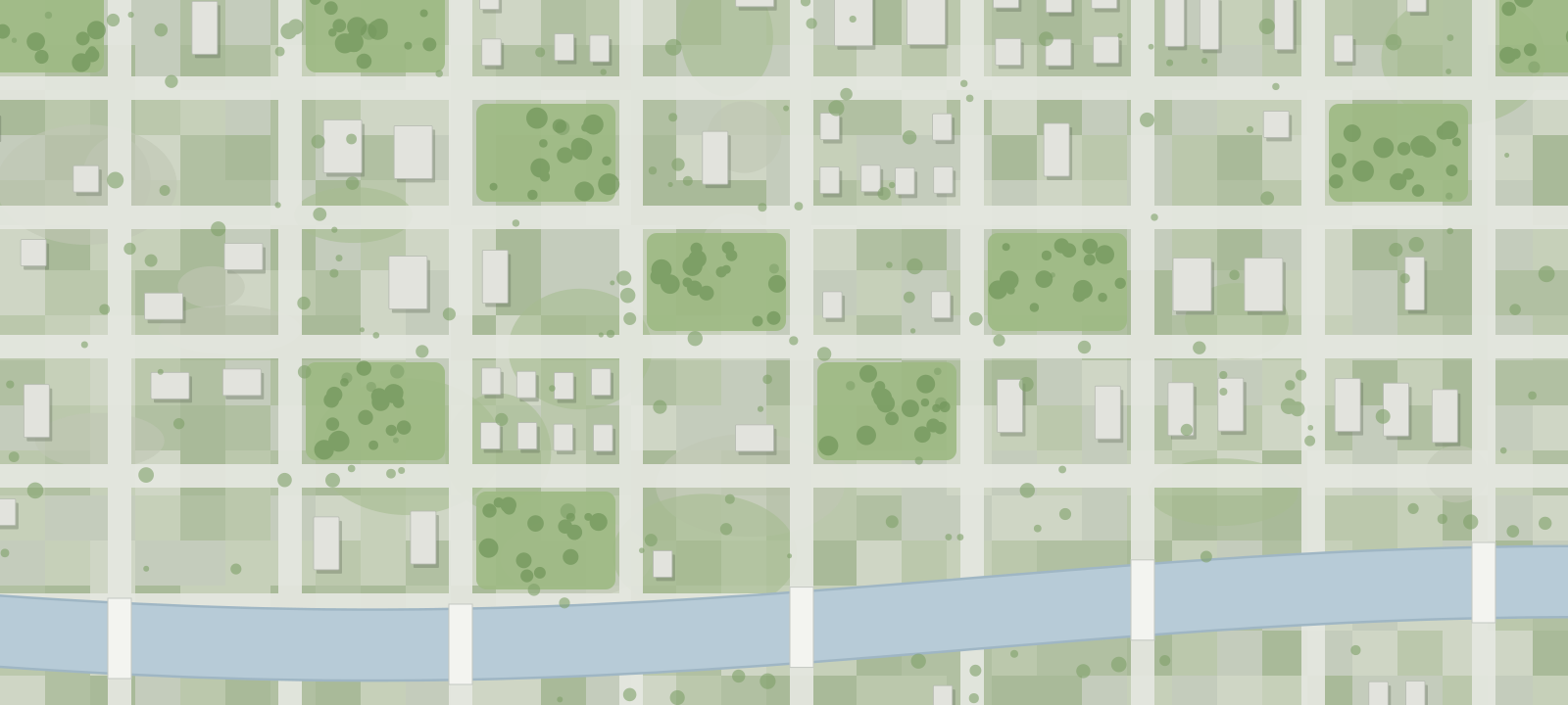
Drag across the drawing to move the divider. The drawing is an illustration of one place, not survey data.
The platform's catalogue: 442 layers in 98 maps from 14 publishers, documented layer by layer with the publisher, the licence and the date of the data. Nothing to download, nothing to convert. Shown here is the Slovenian catalogue; each country page carries its own.
Search an address or a parcel and it is all there. Orthophoto, hillshade and contours, buildings in 3D, print, and a link to the view you are looking at. Free, no sign-in.
The King.Prostor plug-in brings the same data into your drawing: cadastre, buildings with their heights, orthophoto, LiDAR terrain and constraint layers. In AutoCAD, BricsCAD, ZWCAD and GstarCAD.
A part of the catalogue, by theme. Every layer has its publisher, its licence and the date of the data on one page.
GURS
Parcels, cadastral municipalities, parcel edges, land under buildings, building parcels, planned and actual land use, land quality rating, value zones.
GURS
Footprints above and below ground, heights and storeys, year of construction, the building land register.
GURS
Addresses, municipalities, settlements, streets, postal districts, administrative units, school districts, local communities, geographic names, the state border.
GURS
Sewer, water supply, electricity, gas, district heating, electronic communications, roads, railways, airports, ports, cableways, oil pipelines, waste sites, water infrastructure, network access points.
King.Prostor
Computed around roads, railways, electricity, gas, district heating, water, sewer and electronic communications, with the buffer used shown next to each.
MNVP
State spatial plans, municipal plans (OPN, OPPN), planning units, planned land use, regulation lines and areas, acts in preparation.
ARSO
Natura 2000, protected areas and their zones, natural values, ecologically important areas, international protected areas, brown bear habitat.
DRSV
Water protection zones, hydrography, river basins and water bodies, water land with the 5, 15 and 40 m riparian belts, bathing waters, water concessions and permits.
DRSV
Flood areas and the flood warning map, hazard at Q10, Q100 and Q500, hazard classes, water depths at Q100, flood events, the August 2023 flood.
DRSV · GeoZS
Erosion warning map, landslide areas, probability of landslides, rockfalls and debris flows, avalanche areas.
MK
The register of immovable cultural heritage and its legal protection regimes.
MKGP
Actual use of agricultural and forest land (RABA), farm plots (GERK), landscape features, irrigation and drainage systems.
ZGS
Forest management areas and units, stands, forest functions in 40 layers, forest reserves and protective forests, forest roads and firebreaks, damage areas after bark beetle, windthrow and ice storm.
ARSO
Agglomerations, industrial discharges, SEVESO sites, electromagnetic sources, soil monitoring, meteorological and hydrological stations, earthquake hazard and the seismic network.
ARSO
Precipitation for 50 and 100 year return periods, average precipitation, snow cover and snow loads, wind speed and power density, solar radiation, temperature, phenological phases.
GeoZS
The hydrogeological map and the mining book.
ZGS · ARSO
Hunting management areas and hunting grounds, fishing areas, districts and reserves.
GURS · ARSO
Orthophoto, LiDAR terrain, contours and spot heights, 2.5D relief, the national topographic database, the sheet grid.
DRSI · Police · OSM
Actual use of road and railway land, traffic accidents, OpenStreetMap places, roads and buildings.
King.Prostor · GURS
Parcel value, utility connections, year of construction and administrative status as one-click views; parcel history across 23 national snapshots since 2021.
GURS, the Surveying and Mapping Authority · ARSO, the Environment Agency · DRSV, the Water Directorate · ZGS, the Forest Service · MNVP, MKGP and MK, the ministries for spatial planning, agriculture and culture · DRSI, the Infrastructure Directorate · GeoZS, the Geological Survey · the Police · OpenStreetMap · and the layers King.Prostor computes itself.
Three kinds of your own data go on the national map, in the same frame as everything above. A Sewer+ project gets there with one command and travels as one link.
Networks, manholes and pipes, with their attributes, opened in a browser.
Documented on the national map, next to every other network and corridor.
A drawing in its true position. A photo where it was taken.
When the design is ready, one command sends the project to King.Prostor. Manholes and pipes keep their attributes.
Investors and towns open it on top of the national map. No CAD, no install, no file versions to chase.
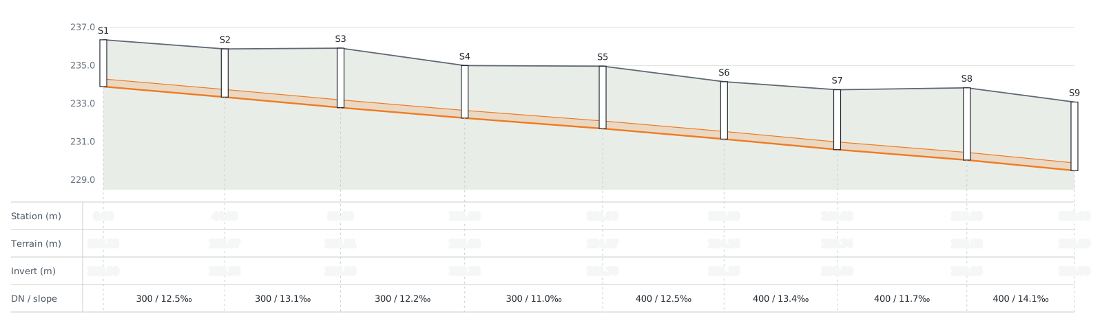
Sewer network design in your CAD: networks, profiles, hydraulics, catalogues and rainfall data. Publish the result to King.Prostor and share one link.
It runs inside AutoCAD, BricsCAD, ZWCAD and GstarCAD.