Design the network. Sewer+ draws the rest.
Sewer+ designs utility networks inside AutoCAD, BricsCAD, ZWCAD and GstarCAD. The project holds the network: pipelines, manholes, the terrain and the design levels. The plan, the longitudinal profiles, the hydraulics and the reports are drawn from it. King.VIA for roads, railways and rivers, and King.Teren for terrain, are part of Sewer+.
Command: SEWEREXPLORER
E 461 885.50 N 101 023.00 D96/TM
Sewer+Project · D96/TM
- Network 1 · Sewer
- Pipeline A
- Pipeline B
- Pipeline C
- Network 2 · Water
The drawing is an illustration of one project, not survey data. The menu items are Sewer+'s own.
One project, every drawing.
Pipelines, manholes, terrain and levels live in the project. Everything below is drawn or calculated from it, and drawn again from it when the design changes. Each item is tagged with its name in the Sewer+ menus.
Networks
New Network
Sewer, storm and waste water, water supply, gas, district heating, electricity and telecom. Each network holds its pipelines, manholes and vertices.
Longitudinal profiles
Draw all Profiles
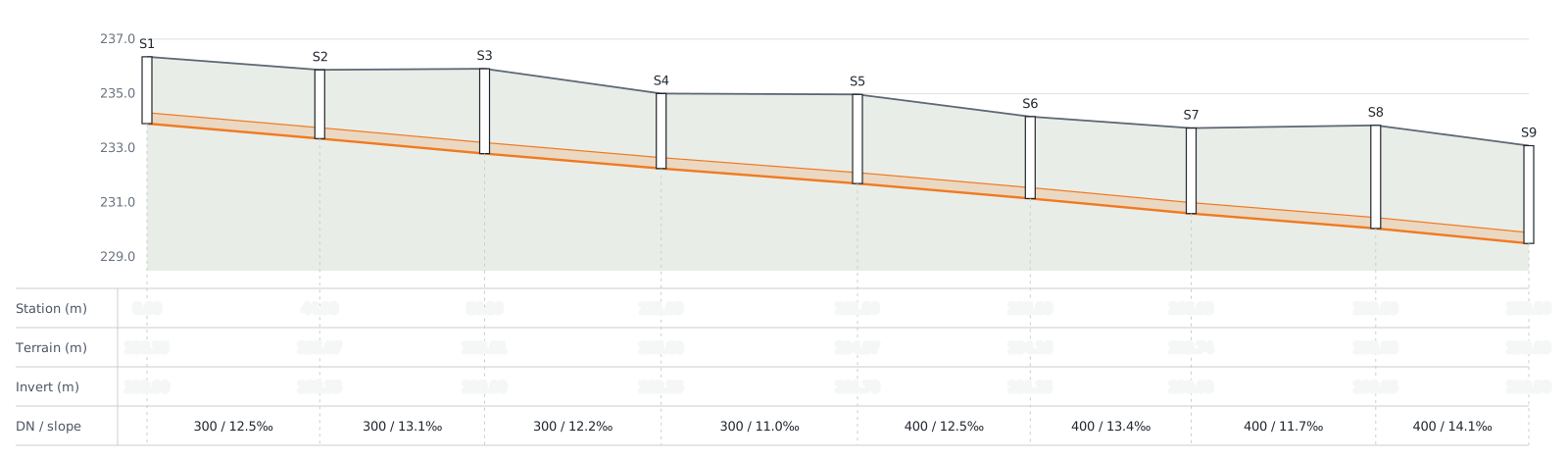
More than 60 configurable table rows, including parcel numbers and utility crossings from King.Prostor. One pipeline, or all of them at once.
Hydraulics
Hydraulics
Retention and rational methods in Sewer+'s own engine. Rain from the Reinhold formula, measured hydrographs or IDF curves: 63 ARSO stations in Slovenia, 92 curves for Czechia. Export to SWMM.
Water supply
EPANET
EPANET built in: demand patterns, pump curves, rule-based controls, scenarios, pressure and flow control valves, and a check for network errors.
Cross sections and volumes
Material Volumes
Trench cross sections along the pipeline, and excavation and material volumes by depth band.
Reports
Manholes and pipes Report
Pipe, manhole and cover reports, and every table straight to Excel.
BIM
BIM export
IFC export of pipes, manholes and excavations, with your own property sets.
King.VIA
King.VIA
Roads with superelevation and swept paths, railways, and river regulation with a full HEC-RAS round trip.
King.Teren
King.Teren
Terrain models with breaklines, contours, cut and fill between surfaces, and terrain solids for DWG and IFC.
Publish to King.Prostor.
A finished design goes on the national map with one command. The people who need it open it as a link, on top of the cadastre and the rest of the national data.
One command in your CAD
When the design is ready, one command sends the project to King.Prostor. Manholes and pipes keep their attributes.
One link in their browser
Investors and towns open it on top of the national map. No CAD, no install, no file versions to chase.
Download Sewer+.
One installer for all four CADs, with King.VIA and King.Teren. Installing is free; working with it needs a licence.
Runs inside
- AutoCAD
- BricsCAD
- ZWCAD
- GstarCAD
In AutoCAD also with Civil 3D.
Where to buy
Slovenia. From SL-King, the maker of Sewer+, directly: sl-king.si, in Slovenian.
Czechia and Slovakia. ROAD-TRAFFIC s.r.o., Ostrava, exclusive partner for sales and support of Sewer+: sewer.cz. In Czech: Sewer+ v češtině.
Other countries. Write to [email protected].